The Grand Canyon: A Historic Junction of Science and Culture
The Grand Canyon stands testament to the beauty of the science and human cultures associated with its grandeur.
Built out of the earth’s crust and its natural elements, the behemoth natural wonder was formed over a staggering 2 billion years, which is just under half the age of the earth itself.
From rocks and silt, to water and winds, the earth’s elements have been a part and parcel in creating and shaping the magnificent wonder.
Watch VIDEO — GRAND CANYON: PLANE/HELICOPTER Tour to the West Rim, Hualapai Tribe and More
As one of seven natural wonders of the world, the Grand Canyon is one of the most visited national parks in the United States, welcoming over 6 million visitors each year.
According to the US National Park Service (NPS), tourists brought in almost $1 billion in revenue to local communities around the Grand Canyon in 2018, helping support 12,558 jobs.
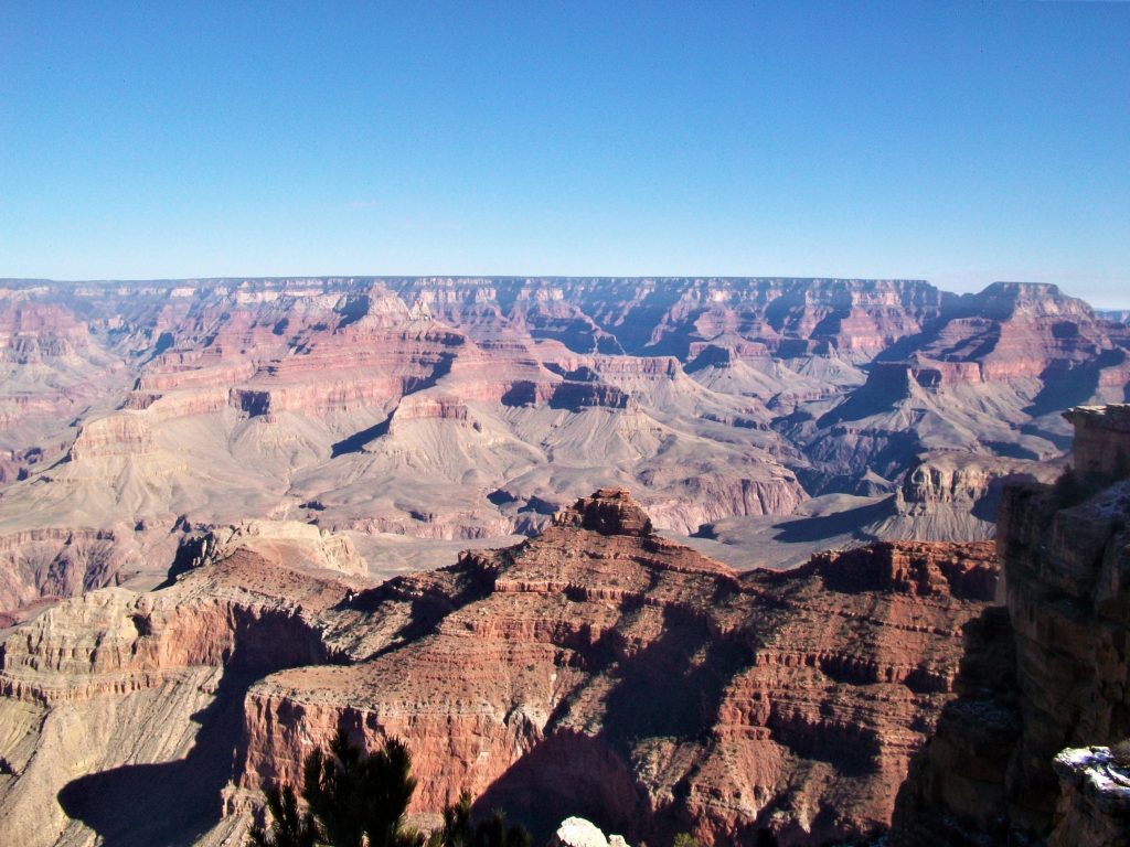
Located in Northwestern Arizona, the Grand Canyon is 446 km long, 29 km wide and more than 1.8 km deep. Its highest elevation is approximately 7,000 ft.
It has four rims — the North, South, East and West.
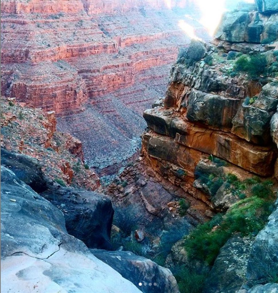
Its colourful, textured layers of rock not only create a visually spellbinding aesthetic with stunning 360 degree views, but also offer insight into millions, if not billions, of years of geologic history.
Geology
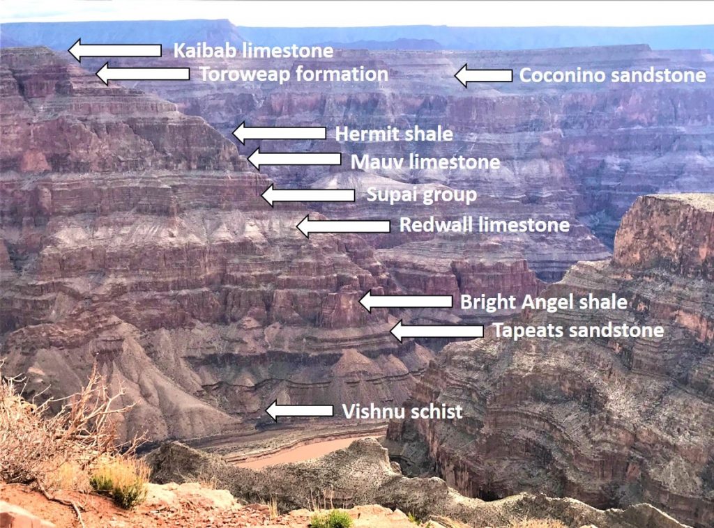
The canyon mainly contains sedimentary rock, with some metamorphic and igneous rock (mainly at its base), consisting of three main types:
- Red sandstone
- Limestone
- Shale (also known as mudstone)
The geology of the Grand Canyon is complex and reflects its long and changing history. There are about 40 different rock layers exposed in the canyon, which range from being 200 million to 2 billion years old.
There are three main rock layer sets in the Grand Canyon:
1) Metamorphic basement rocks (early Proterozoic Vishnu Group)
- Mainly metamorphic rocks, with some igneous rocks (i.e. granite)
- Date back 1.8 billion years
2) The Precambrian Grand Canyon Supergroup
- Primarily sandstone and mudstone sedimentary rocks, with some igneous rock from the late Proterozoic era
- Only slightly younger than the metamorphic basement rocks
- Few fossils
3) Paleozoic strata
- Primarily sandstone sedimentary rock
- The reddish layers often seen in pictures
- Youngest rock layers — the youngest layer is the Kaibab limestone at 270 million years old
- Contains many fossils of sea creatures such as brachiopods, coral and crinoids — indicates there was once a warm, shallow sea there
Formation
So what led to the formation of this mammoth crater-like 3D imprint within the earth?
It may be hard to believe that the current-day desert landscape of the Grand Canyon and surrounding areas were once almost all underwater. Once that water began to recede, the formation of the canyon began.
Canyon Science
Canyons are formed from a combination of erosion, weathering, movement of rivers and tectonic plate activity.
The following are highlights of the process that formed the Grand Canyon:
Rock deposition: Development of the canyon first began with the formation and deposition of layers of igneous and metamorphic rocks at its base — these are known as the Vishnu rocks.
Tectonic plate action: About 30 to 70 million years ago, shifting and colliding of tectonic plates (namely the North American and Pacific plates) in the region caused the land to uplift to form the Colorado Plateau. The plateau forms a physiographic region that extends across the US southwest, covering the southeastern half of Utah, western and southwestern Colorado, northwestern New Mexico and the northern half of Arizona.
The Colorado River: The Colorado River is believed to have arisen 5 to 6 million years ago. It is known as the lifeline or heart of the Southwest, having helped sustain life and activity in the region for centuries, traversing 7 US states and 2 Mexican states. It cut through the Grand Canyon to help carve it out and still winds its way through it today. Although the river is only on average about 100 m wide, its powerful forces have helped create the sharp bends and textures of the canyon.
Erosion: Finally, erosion of the canyon rocks by winds and rain have shaped and chiselled out its simultaneously jagged and smooth edges, with the process continuing as we speak. The high elevation of the Grand Canyon (due to uplifting of the land) has made it more susceptible to the elements, resulting in higher rates of erosion.
The People of the Land
The canyon has been inhabited by Native American tribes for centuries.
Some of the Indigenous tribes in the region include the Hualapai, which translates to ‘people of the pines,’ and the Havasupai, which translates to ‘people of the blue-green water,’ referring to the waters of the Havasu Canyon (located about 4 hours from the Grand Canyon).
The Indigenous Paiute tribe has given the canyon the name ‘Kaibab,’ which means ‘mountain lying down’ or upside down mountain.
The Havasupai tribe re-gained ownership to parts of the Grand Canyon lands in 1975, after having been bordered off on a small 518 acre reservation.
However, continued federal red taping has prevented Indigenous tribes in the region to develop infrastructure in the area, including access to resources such as water from nearby Lake Powell (a man-made reservoir on the Colorado River).
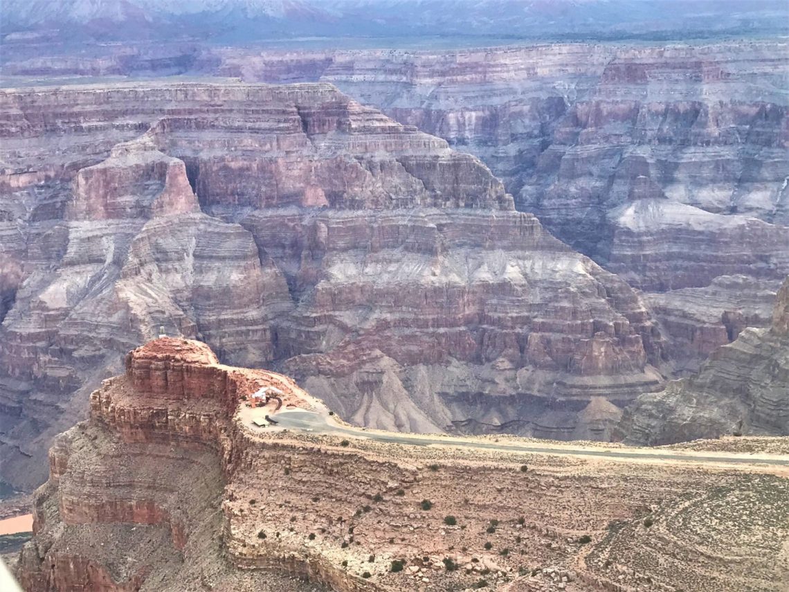
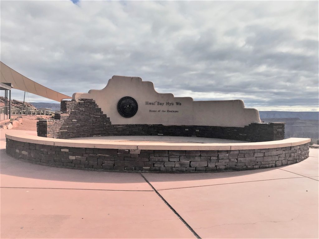
The West Rim of the Grand Canyon lies on the Hualapai reservation. Over the years, the Hualapai have been able to build tourism at the West Rim, including commissioning of the Skywalk at Eagle Point, a horseshoe-shaped glass bridge that extends 70 feet out from the edge of the canyon.
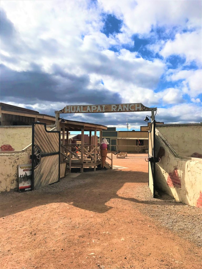
The Hualapai tribe also offers other tours including boat and rafting trips, as well as performances at Eagle Point and the Hualapai Ranch, a western-style ranch displaying both American midwest and native cultures. You can also tour a traditional Hualapai village near the ranch.
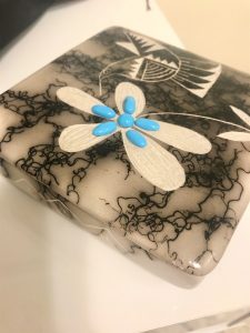
You can also get beautiful hand-crafted jewelry and decorative pieces made by the Indigenous Hualapai, Hopi and Mojave tribes at the Native Hands gift shop at Eagle Point.
Trips
Hiking In
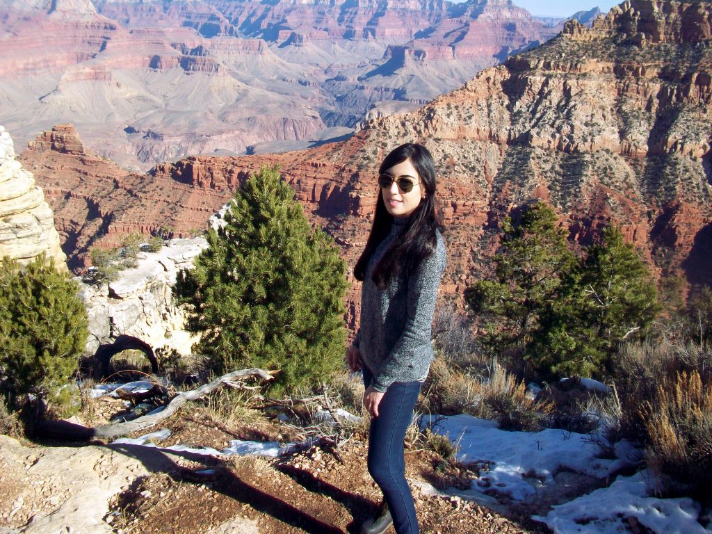
I first visited the South Rim of the Grand Canyon in 2016. I was taken aback by the breadths, depths, beauty and serenity that it harbours. And yes, pictures just don’t do any justice to it at all!
Pictures not only fail to capture the dimensions, crevices and juxtaposition of the sandy, jagged textures of the canyon — from the sharp, rough cuts of the layered rocks to the soft sands sweeping over the pinkish red sedimentary rocks, creating a halo-like, translucent effect — but also the general feel and essence that it exudes.
Just standing there realizing that you’re looking out at billions of years of earth’s history is mindboggling in itself. And despite that, there is a simplicity and calm to it.
To take in the grand visuals more up close, I went hiking into the canyon on the Hermit’s Trail, which was an incredibly difficult 2-mile trek, but offered amazing views of the canyon. I would recommend this only if you have the time and might to climb back up the winding array of dishevelled, rocky trails!
Flying in
In March 2019, I had the opportunity to go to the canyon again as I was visiting Las Vegas. This time my trip was a bit different because due to time constraints, I booked a helicopter tour to the canyon with Maverick Helicopters. It was a very well-organized tour, making for a great experience. You can visit their website to see the different tour packages they have. The package I booked is no longer available but there are many others to choose from.
The tour I booked included a plane ride to the West Rim of the Grand Canyon, followed by a helicopter dive into it!
The tour began with a pick-up from the hotel (a limo or small van from Maverick does pick-ups from designated hotels on the Las Vegas strip) that took us to the Henderson Airport, which is less than a 20-minute drive from the Las Vegas strip.
Making our way to the canyon, we flew over deserts, small mountains and volcanoes, which are thankfully inactive! The flight took us over the Hoover Dam, an enormous dam built in the early 20th century on the Arizona – Nevada border, which made use of the Colorado River to provide water and hydroelectric power for the developing Southwest at the time.
Once at the West Rim, a shuttle bus took us to different viewing points to take in the spectacular views. The shuttle bus service was really great, with buses arriving every five minutes at the stops. And no view is possibly a bad view at the Grand Canyon!
The tour also included lunch at the Hualapai ranch.
Following that, we boarded a helicopter to take us down into the canyon. This was doubly exciting because it was my first time being in a helicopter and my first time diving into a canyon from the skies!

Our pilot, John Fitzgerald from Maverick Helicopters, was awesome, as he cracked jokes and played epic music as we took off and barreled into the canyon.
Upon landing, we had some time to explore, getting up close to the Colorado River, which had a quiet stillness to it. It was murky from the sand, silt, mud and rocks seeping into it.
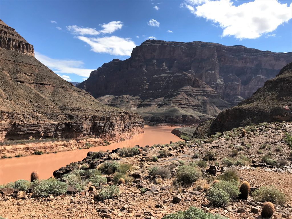
Despite the calm, unassuming nature of the river, its centricity serves as a reminder of its key role in the formation of the canyon. It’s hard to imagine that this barely-100 m-wide river has helped etch out such a grand and ornate spectacle.
The Grand Canyon is truly a testament to the history, science and people of the land, which are continually evolving, but remain firmly anchored by their foundations, giving life to the richly unique landscape.

You May Also Like

We Must Cancel Christmas This Year if We Want to Have One Next Year

COVID-19 Vaccines: A Rundown of What is Going Down